For most outdoors people, Google Earth/Maps is the go-to resource for aerial images. From searching a new hiking route, checking on the progress of new developments, to assessing the about of forest that’s been lost to logging, free satellite imagery is one of the true “gifts” of the Internet age.
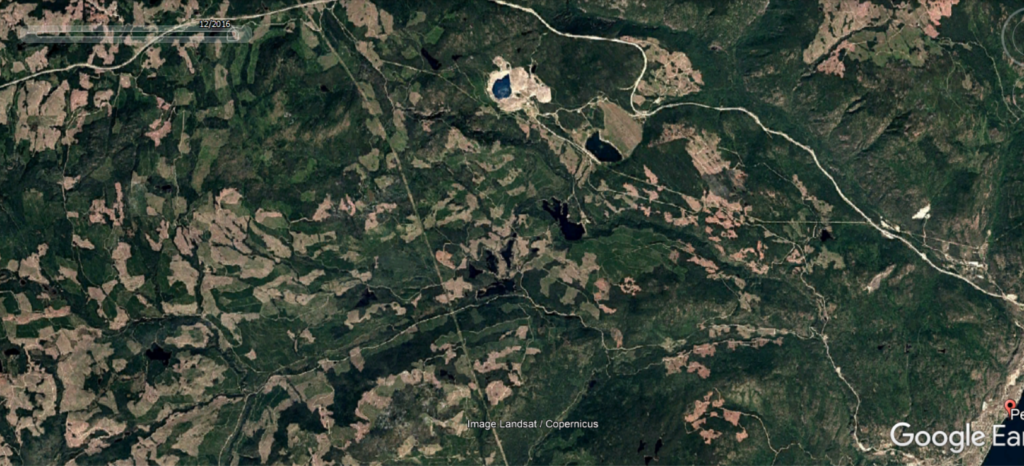
However, did you know that much of the imagery on Google Earth/Maps is at least 4 years old. In some areas it’s even older. The Google high resolution imagery for Peachland’s watershed for example is from 2016. With amount of logging and mining exploration in the area this data is often not useful.
There is a new free satellite imagery provider whose data is uploaded every 10 days.
The Sentinel Playground is the place you can easily access these images and it works almost like Google Earth. For the techies who are reading this there are also a few more “bells and whistles” – you can view the different satellites’ images, and the different “bands” of light (spectrums) depending on the purpose of your search.
For most of us interested in logging activity, the real colour band (the default) works just fine.
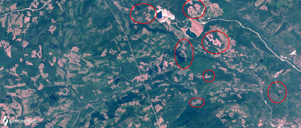
These photos show the most current Google Earth images of our watershed, from 2016. While the second one shows the same approximate area, from data gathered on August 15.
The circles show new logging activity since 2016, some of it happened this year and was verified by our Watershed Watch team.
If you’re wondering why the location marked with the *is so small compared to the other clear-cuts it’s because this area was logged by Ntityix Resources which is the First Nations owned business from Westbank, that’ implementing logging practices based on indigenous traditional knowledge and understanding of the natural systems in our watershed. You can read more about this specific project here. Link to pwpa report